


THE VILLAGE AND ITS WATER SUPPLY
A common modern day assumption in regard to the water supply of a village like Blewbury is that each house had a well. Well, pun intended, this is not the case. An 1875 map of the village shows the houses and locations of wells and the existence of six pumps.
The pumps are of real interest as they would have been used to draw drinking water from underground sources and the houses that had them were those of some importance within the village.
They water pumps were located at:
rear of Watts Barn on Watts Lane
rear of Great Tree off London Road
Hall Barn on Westbrook Street
Ashbrook Mews (as now is) shows as having a pump either side
between the Red Lion and Hall Barn Close
at the front of Dibleys
adjacent to the road in front of the New Inn -
The wells were located at:
SOUTH STREET -
CHURCH ROAD -
LONDON ROAD -
WESTBROOK STREET -
NOTTINGHAM FEE -
HEATHER WAY -
There are some in existence today that do not show on the map. We can assume either they had not yet been dug or were out of use. The streams were used as a water source even into the 1920’s: the parish council records carry reports of problems such as 'a person washing his horse at Naylesbridge when it supplied the drinking water for five houses below'.
WELLS NOT ON THE 1875 MAP
FIR TREES -
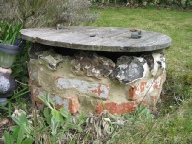
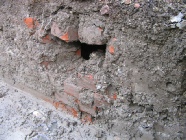
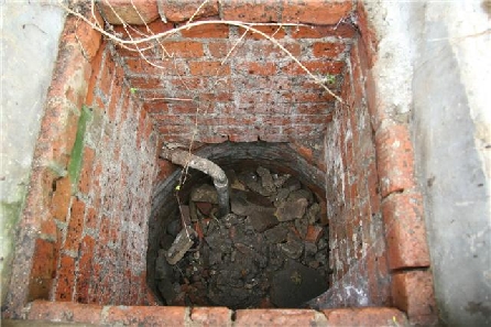
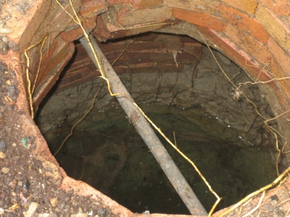
WATTS BARN (Taken from the footings of the current wall running along Watts Lane prior to building. Shows bricks had no mortar joints, level of water is to bottom of trench). This well is not shown on the map.
TO BE CONTINUED
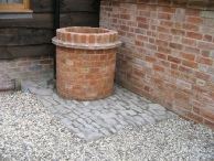
The same well, renovated by local tradesmen. The water level is not constant, dropping upto 4 feet.
The Cottage -
WOODWAY STABLES -
LITTLE TRITON -
WATERY LANE STUDIO -
Photo courtesy of Mark Vaughan.
Hollytree Cottage well was located on what is now the driveway to the front of the house, approx. 6 feet and 45 degrees from the corner of the old part of the Cottage. This makes it directly in line with that well still in existence at Sawyers which would have served the Pub.
Ron Conway's experience of the well at Sheencroft during his spell as an evacuee here:
"…we were evacuees from the big smoke and practically everything was new and quaint for us and the well was no exception. The well was situated behind the woodshed which was called the Hovel by the Greenough’s with whom I stayed and was shared by the Wilmot’s who lived next door with a dividing 6 foot high fence separating the backyards;
The well was covered with a rough timber platform built over it and had a square trapdoor for safety with a bolt which could be locked if kids were around. There was quite a knack of drawing water, for when the water level was low a rope had to be attached and the bucket let down and given a quick flick to enable the bucket to tilt and sink and fill. When we had a high water level we could simply lay down and sink the bucket at arms length to draw water.; I must add that the grown ups were a little perturbed when they found out that we did this as falling into the well was always a great concern to them. The well was lined with bricks and if the bucket was accidentally dropped it had to be forked out with a rake or pitchfork causing plenty of sediment to be disturbed and no clear water until it had settled. The water kept extremely cold which was appreciated in the occasional hot weather we sometimes experienced. Needless to say the story of the mouse accidentally scooped up in the dark and the clogged teapot will be left to your imagination!"
| Schools |
| Houses |
| Military |
| Places of Worship |
| Racing Stables |
| People |
| Wells and pumps |
| Pre 1914 |
| 1914-18 |
| 1939-45 |
| Artists Books |
| St Michaels Church |
| Public Houses |
| Path of Duty vol 2 |